 |
 |
On the map itself, Piri Reis explains how he actually made it. This is the kind of map every collector dreams of. It is unique, visually attractive, cartographically very interesting. It was discovered in 1929 while Topkapi Palace was being converted into a museum. What fascinate me most are the marginal notes on the accounts of the pioneer seamen who have taken part in the discovery of the places shown on the map. Some of these are exagerated adventure stories. Below is the translation of these notes taken from The Oldest Map of America, by Professor Dr. Afet Inan. Ankara, 1954. You can read the translations of the notes by clicking them on the map.
|
|
|
|
||
|
I. There is a kind of red dye called vakami, that you do not observe at first, because it is at a distance . . . the mountains contain rich ores. . . . There, some of the sheep have silken wool. To top II. This country is inhabited. The entire population go naked. To top III. This region is known as the Vilayet (province) of Antilia. It is on the side where the sun sets. They say that here there are four kinds of parrots, white, red, green and black. The people eat the flesh of parrots and their head-dress is made entirely of parrot feathers. There is a stone here. It resembles black touchstone. The people use it instead of an axe. That it is very hard . . . [illegible].... saw that stone. To top [NOTE: Piri Reis writes in the "Bahriye": "In the enemy ships which we captured in the Mediterranean, we found a head-dress made of these parrot feathers, and also a stone resembling the touchstone." To top IV. This map was drawn by Piri Ibn Haji Mehmed, known as the nephew of Kemal Reis, in Gallipoli, in the month of Muharrem of the year 919 (that is, between the 9th of March and the 7th of April of the year 1513). To top V. This section tells how these shores and also these islands were discovered. These coasts are named the shores of Antilia. They were discovered in the year 896 of the Arab calendar. But it is reported thus, that a Genoese infidel, his name was Colombo, who discovered these places. For instance, a book fell into the hands of the said Colombo, and he found it said in this book that at the end of the Western Sea [Atlantic] that is, on its western side, there were coasts and islands and all kinds of metals and also precious stones. Colombo, having studied this book thoroughly, explained these matters one by one to the greats of Genoa and said: "Come, give me two ships, let me go and find these places." They said: "O unprofitable man, can an end or a limit be found to the Western Sea ? Even its vapour is full of darkness." The above-mentioned Colombo saw that no help was forthcoming from the Genoese, he sped forth, went to the Bey of Spain [king], and told his tale in detail. They too answered like the Genoese. In brief Colombo petitioned these people for a long time, finally the Bey of Spain gave him two ships, saw that they were well equipped, and said: To top "O Colombo, if it happens as you say, let us make you the "kapudan" [admiral] to that country." Having said this, he sent the said Colombo to the Western Sea. The late Gazi Kemal had a Spanish slave. The above-mentioned slave said to Kemal Reis, he had been three times to that land with Colombo. He said: "First we reached the Strait of Gibraltar, then from there straight south and west between the two . . . [illegible]. Having advanced straight four thousand miles, we saw an island facing us, but gradually the waves of the sea became foamless, that is, the sea was becalmed and the North Star - which the seamen on their compasses still call the star - little by little was veiled and became invisible, and he also said that the stars in that region are not arranged as here. They are seen in a different arrangement. They anchored at the island which they had seen earlier across the way, the population of the island came, shot arrows at them and did not allow them to land and ask for information. The males and the females shot hand arrows. The tips of these arrows were made of fishbone, and the whole population went naked and also very . . . [illegible]. Seeing that they could not land on that island, they crossed to the other side of the island where they saw a boat. On seeing them; the boat fled and they [the people in the boat] dashed out on land. They [the Spaniards] took the boat. They saw that inside of it there was human flesh. It happened that these people were of the kind who went from island to island hunting men and eating them. They said Colombo saw yet another island, they neared it, they saw that on that island there were great snakes. They avoided landing on this island and remained there seventeen days. The people of this island saw that no harm came to them from this boat, they caught fish and brought it to them in their small boats. These [Spaniards] were pleased and gave them glass beads. It appears that he [Columbus] had read-in the book that in that region glass beads were valued. Seeing the beads they brought still more fish. These [Spaniards] always gave them glass beads. One day they saw gold around the arm of a woman, they took the gold and gave her beads. They said to them "bring more gold, we will give you more beads". They went and brought them much gold. It appears that in their mountains there were gold mines. One day, also, they saw pearls in the hands of one person. They saw that when; they gave beads, many more pearls were brought to them. Pearls were found on the shore of this island, in a spot one or two fathoms deep. And also loading their ship with many logwood trees and taking two natives along, they carried them within that year to the Bey of Spain. But the said Colombo, not knowing the language of these people, they traded by signs, and after this trip the Bey of Spain sent priests and barley, taught the natives how to sow and reap and converted them to his own religion. They had no religion of any sort. They walked naked and lay there like animals. Now these regions have been opened to all and have become famous. The names which mark the places on the said islands and coasts were given by Colombo, that these places may be known by them. And also Colombo was a great astronomer. The coasts and island on this map are taken from Colombo's map. To top VI. (This section explains in what way this map was drawn). In this century there is no map like this map in anyone's possession. The hand of this poor man has drawn it and now it is constructed from about twenty charts and Mappae Mundi (these are charts drawn in the days of Alexander, Lord of the Two Horns, which show the inhabited quarter of the world; the Arabs name these charts Jaferiye), from eight Jaferiyes of that kind and one Arabic map of Hind, and from the maps just drawn by four Portuguese which show the countries of Hind, Sind and China geometrically drawn, and also from a map drawn by Colombo in the western region. By reducing all these maps to one scale this final form was arrived at. So that the present map is as correct and reliable for the Seven Seas as the maps of our own countries are considered correct and reliable by seamen. VII. It is relayed by the Portuguese infidel that in this spot night and day are at their shortest of two hours, at their longest of twenty two hours. But the day is very warm and in the night there is much dew. To top VIII. On the way to the vilayet of Hind a Portuguese ship encountered a contrary wind [blowing] from the shore. The wind from the shore . . . [illegible] it [the ship]. After being driven by a storm in a southern direction they saw a shore opposite them they advanced towards it [illegible]. They saw that these places are good anchorages. They threw anchor and went to the shore in boats. They saw people walking, all of them naked. But they shot arrows, their tips made of fishbone. They stayed there eight days. They traded with these people by signs. That barge saw these lands and wrote about them which. . . . The said barge without going to Hind, returned to Portugal, where, upon arrival it gave information. . . . They described these shores in detail. . . . They have discovered them. To top IX. And in this country it seems that there are white-haired monsters in this shape, and also six-horned oxen. The Portuguese infidels have written it in their maps. . . . To top X. This country is a waste. Everything is in ruin and it is said that large snakes are found here. For this reason the Portuguese infidels did not land on these shores and these are also said to be very hot. To top XI. And these four ships are Portuguese ships. Their shape is written down. They travelled from the western land to the point of Abyssinia [Habesh] in order to reach India. They said towards Chalice. The distance across this gulf is 4200 miles. To top XII. .... on this shore a tower .... is however .... in this climate gold .... taking a rope .... is said they measured [NOTE: The fact that half of each of these lines is missing is the clearest proof of the map's having been tom in two.] To top XIII. And a Genoese kuke [a type of ship] coming from Flanders was caught in a storm. Impelled by the storm it came upon these islands, and in this manner these islands became known. To top XIV. It is said that in ancient times a priest by the name of Sanvolrandan (Santo Brandan) travelled on the Seven Seas, so they say. The above-mentioned landed on this fish. They thought it dry land and lit a fire upon this fish, when the fish's back began to burn it plunged into the sea, they reembarked in their boats and fled to the ship. This event is not mentioned by the Portuguese infidels. It is taken from the ancient Mappae Mundi. To top XV. To these small islands they have given the name of Undizi Vergine. That is to say the Eleven Virgins. To top XVI. And this island they call the Island of Antilia. There are many monsters and parrots and much logwood. It is not inhabited. To top XVII. This barge was driven upon these shores by a storm and remained where it fell. . . . Its name was Nicola di Giuvan. On his map it is written that these rivers which can be seen have for the most part gold [in their beds]. When the water had gone they collected much gold [dust] from the sand. On their map. . . . To top XVIII. This is the barge from Portugal which encountered a storm and came to this land. The details are written on the edge of this map. [NOTE: see VIII. To top XIX. The Portuguese infidels do not go west of here. All that side belong entirely to Spain. They have made an agreement that [a line] two thousand mile., to the western side of the Strait of Gibraltar should be taken as a boundary. The Portuguese do not cross to that side but the Hind side and the southern side belong to the Portuguese. To top XX. And this caravel having encountered a storm was driven upon this island. Its name was Nicola Giuvan. And on this island there are many oxen with one horn. For this reason they call this island Isle de Vacca, which means, Ox Island. To top XXI. The admiral of this caravel is named Messir Anton the Genoese, but be grew up in Portugal. One day the above-mentioned caravel encountered a storm, it was driven upon this island. He found much ginger here and has written about these islands. To top XXII. This sea is called the Western Sea, but the Frank sailors call it the Mare d'Espagna. Which means the Sea of Spain. Up to now it was known by these names, but Colombo, who opened up this sea and made these islands known, and also the Portuguese, infidels who have opened up the region of Hind have agreed together to give this sea a new name. They have given it the name of Ovo Sano [Oceano] that is to say, sound egg. Before this it was thought that the sea had no end or limit, that at its other end was darkness. Now they have seen that this sea is girded by a coast, because it is like a lake, they have called it Ovo Sano. To top XXIII. In this spot there are oxen with one horn, and also monsters in this shape. To top XXIV. These monsters are seven spans long. Between their eyes there is a distance of one span. But they are harmless souls. To top |
||
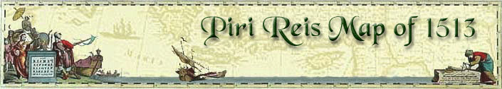
 This is a manuscipt map drawn in 1513 by Piri Reis a Turkish captain who later became the Chief Admiral of the Ottoman Navy. It was presented to Ottoman Sultan Selim I in Egypt in 1517.
 |

|
 |
|